
Beagle Channel and Ushuaia
We awoke this morning with a headwind, which was a good thing, because it brought to us an unimaginable number of sooty shearwaters, as well as lots and lots of great shearwaters, giant petrels, and black-browed albatrosses. They were probably finding plenty of stuff to eat, too, judging by how often birds were dropping to the water’s surface and squabbling over unseen objects. Floating patches of kelp especially interested them and albatrosses could be seen walking about on the mats searching and poking for…well, whatever. By mid-morning, we reached Estrecho de le Maire (no relation to the Lemaire Strait we transited earlier in the Antarctic Peninsula) and picked up more species, including southern sea lions and dusky dolphins. This body of water is about 50 miles (80km) wide and separates Isla de los Estados (Staten Island) from Isla Grande de la Tierra del Fuego.
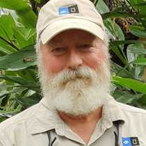
The ship made very good speed yesterday and throughout today, so that by mid-afternoon, we had entered the protected waters of the Beagle Channel, named for HMS Beagle, made famous by the exploits of Charles Darwin in the middle 1830s. Actually, it was the captain of HMS Beagle, Robert Fitzroy, who charted these waters on an earlier voyage that gave the name to the waterway. We picked up the channel pilot (Figure A) and continued making our way westward, with Argentina to starboard and Chile to port, all the way to Ushuaia. The Beagle Channel runs along the south shore of Tierra del Fuego and must surely be one of the most scenic waterways in the world. We only got to see the eastern half of the channel, but it continues right across Patagonia through the Chilean Fjordland into the Pacific Ocean. As we neared Ushuaia, the spine of the Cordillera Darwin came into view. Some of these mountains still had snow on their peaks, and we know from other voyages that numerous glaciers form within these mountains farther west. This southerly terrain has been modified by intense glaciation in the recent past and presents textbook quality examples of many aspects of glaciology, such as hanging and U-shaped valleys, arêtes, alluvial plains, moraines, and low, rounded hills. The treeline is very obvious along the Beagle Channel, because at this latitude it is at a very low altitude…perhaps 1,500 feet (about 450 meters). See Figure B.
We arrived at Ushuaia during dinner and soon had all the paperwork completed and our guests had a chance to go ashore to enjoy the nightlife of what is now the southernmost city in the world. However, Ushuaia had very meager beginnings when a lonely British mission station was set up here in 1870 to work with the Yaghan Indians. About 15 years later, the settlement was made into an Argentine penal colony, along with nearby Staten Island. In the 1950s, it became an important Argentine naval base. In recent years, the Argentinian government has made efforts to induce people to move permanently to Ushuaia with tax incentives, developing technological industries for jobs, and a higher than average pay scale. This plan has been relatively successful and Ushuaia now has a population of more than 50,000 people. It is a duty-free port, and as a gateway to Antarctica it has become an important player in Argentina’s tourist economy, which is why we came here.